A new perspective on Carbon Credit measuring
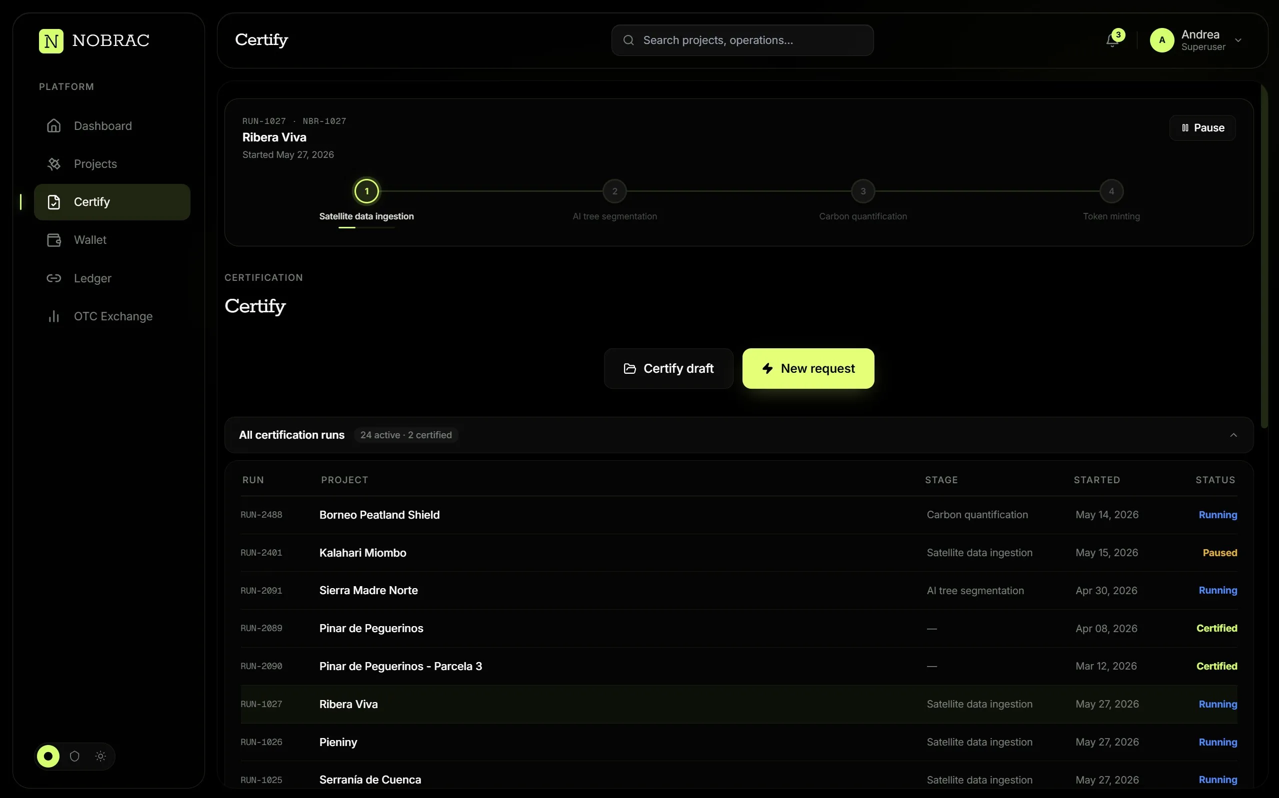
Verification, certification and custody in just one platform.
Every hectare, seen from space.
Through the clouds, not around them.
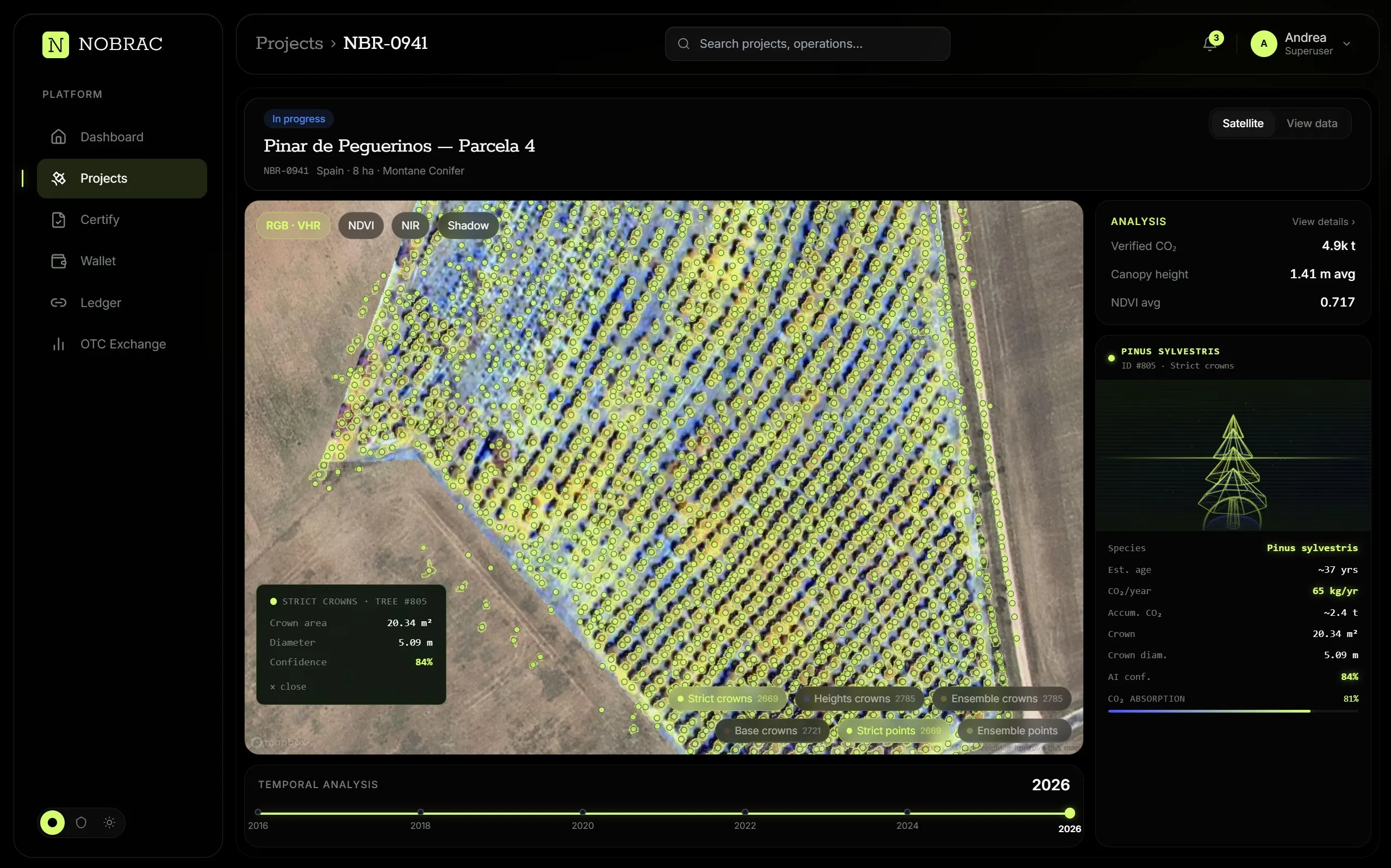
Every crown, delineated.
Every tree, measured.
We make every tree count.
The challenge
Carbon credit projects are growing, but verification is still slow, costly and fragmented.
5+
separate vendors in a traditional verification
73%
of CDR project costs can be MRVGrantham Research Institute, LSE, 2023
$150k
MRV cost of an average project, plus integration
- 01
Prohibitive costs
MRV (Measurement, Reporting, and Verification) represents up to 73% of CDR (Carbon Dioxide Removal) project costs (Grantham/LSE, 2023). Evidence becomes a luxury that small and medium projects can't afford.
- 02
Lack of precision
Manual sampling extrapolates a handful of plots across hundreds of hectares, while low-resolution satellite imagery carries high margins of error.
- 03
Fraud and greenwashing
High-profile fraud and quality failures have surfaced in recent years, eroding confidence in the market. When trust breaks, credit collapses.
- 04
Fragmentation
Carbon credit issuance involves multiple separate actors with different methodologies. Every handoff adds cost, delay, and risk.
Our products
Five products. One evidence chain.
From carbon planning to asset management, connected by traceable evidence.
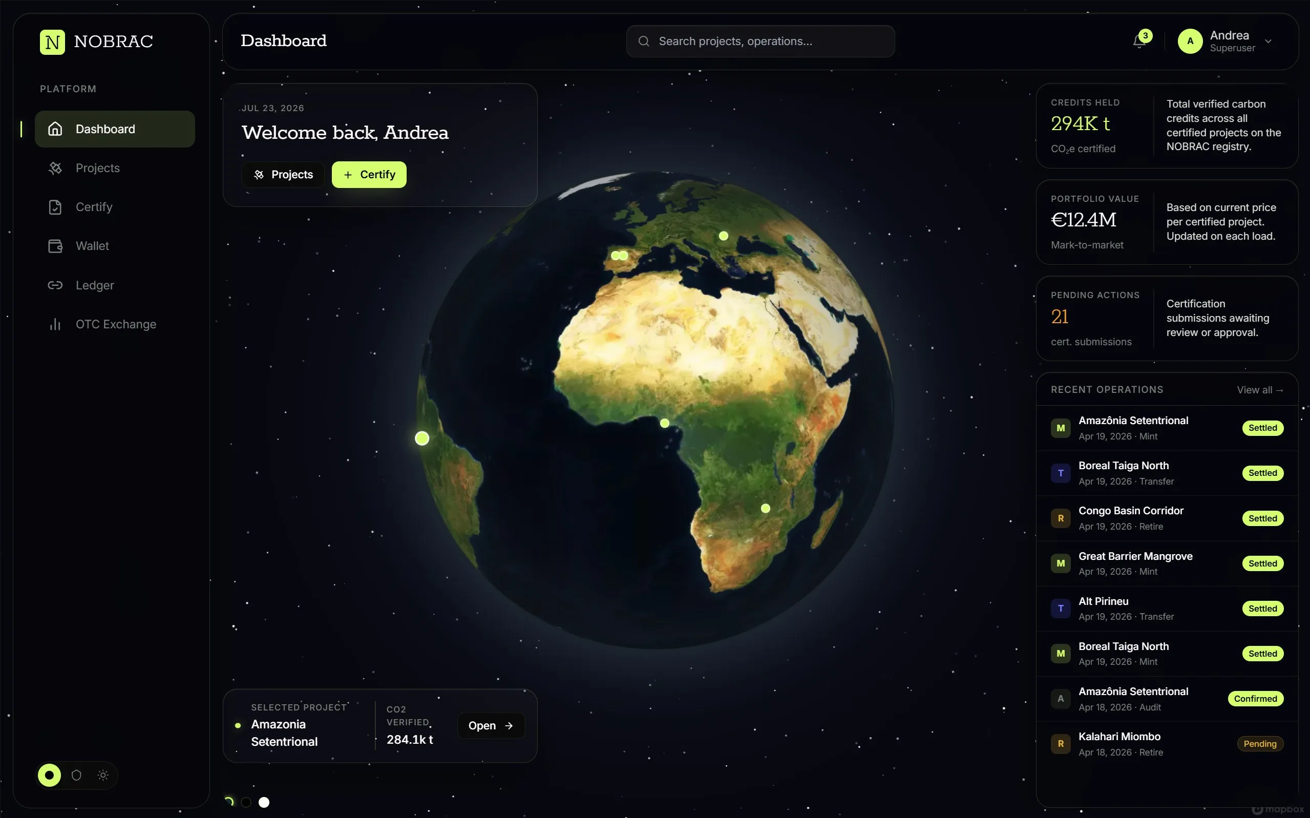
The future of Carbon, now.
We use satellite based growth models calibrated to your site's specific soil, climate, and species conditions to project future biomass and carbon trajectories with precision. Our forecasts are connected to monitoring data and update continuously as reality unfolds. For developers, the solution helps predict credit issuance schedules with confidence. For financiers, it enables modeling the underlying asset across its entire lifecycle.
Learn moreNothing goes undetected.
We use very high resolution multispectral imagery and Sentinel satellites together for recurring, high-frequency observation. This helps detect disturbances within days of them happening, giving you the information you need to act before small issues become bigger problems. Every pass adds to a continuous evidentiary record that connects each phase of the credit lifecycle.
Learn moreTransparency is our commitment.
Each deliverable comes with a full evidentiary package to make all data traceable: source hashes, model versions, parameter logs, ground-truth references, and methodology citations. Reports for CRCF, EUDR, Paris Art. 6, and EU ETS Phase IV are auto-generated and connected directly to the underlying data, not written up separately, so what you submit always reflects what the system actually measured.
Learn moreProtect value, anticipate risk.
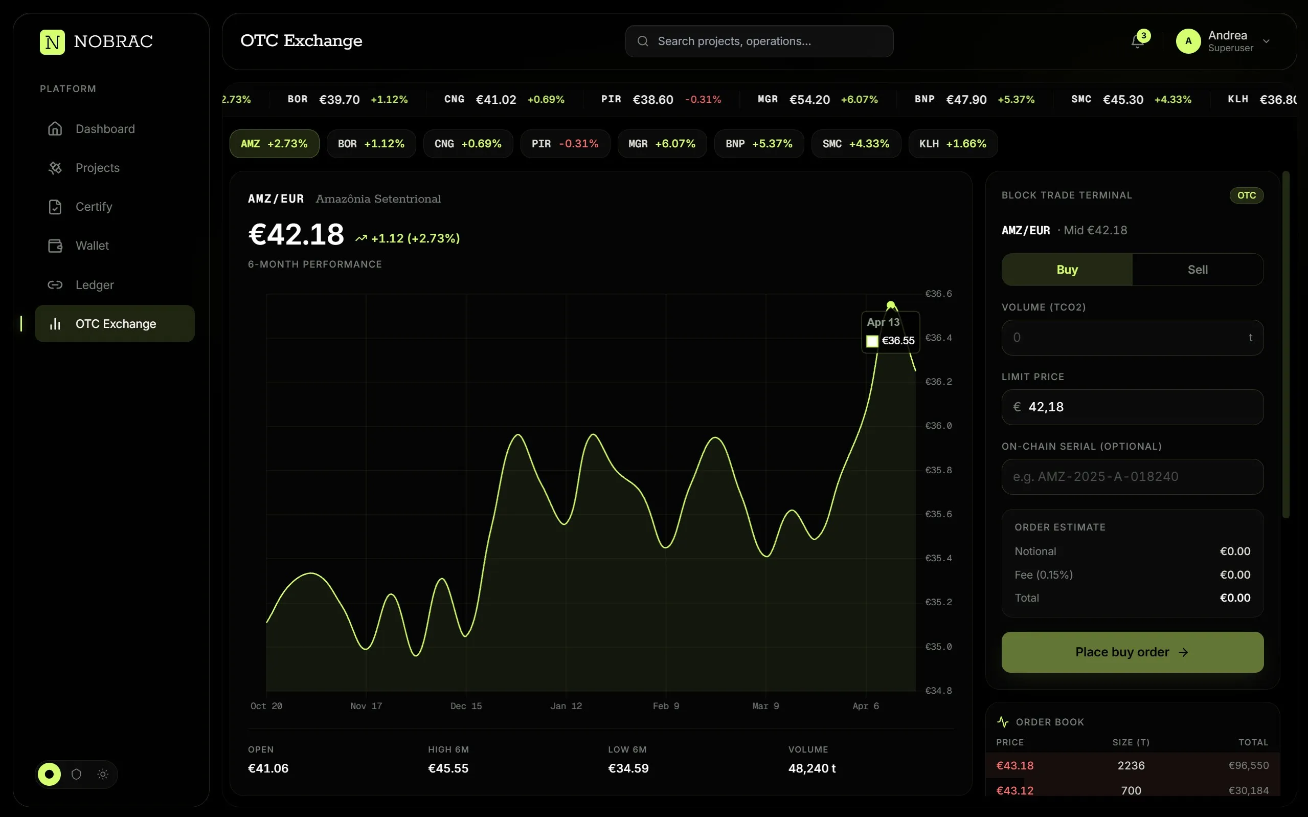
For carbon project developers, credit owners, and investors, we offer insurance and derivative products to protect carbon assets and manage future delivery and price risks. Our products will draw on carbon measurements, growth forecasts, and satellite monitoring, connecting coverage and contract terms to the performance of the underlying projects.
Learn moreYour credits. Their story. One place.
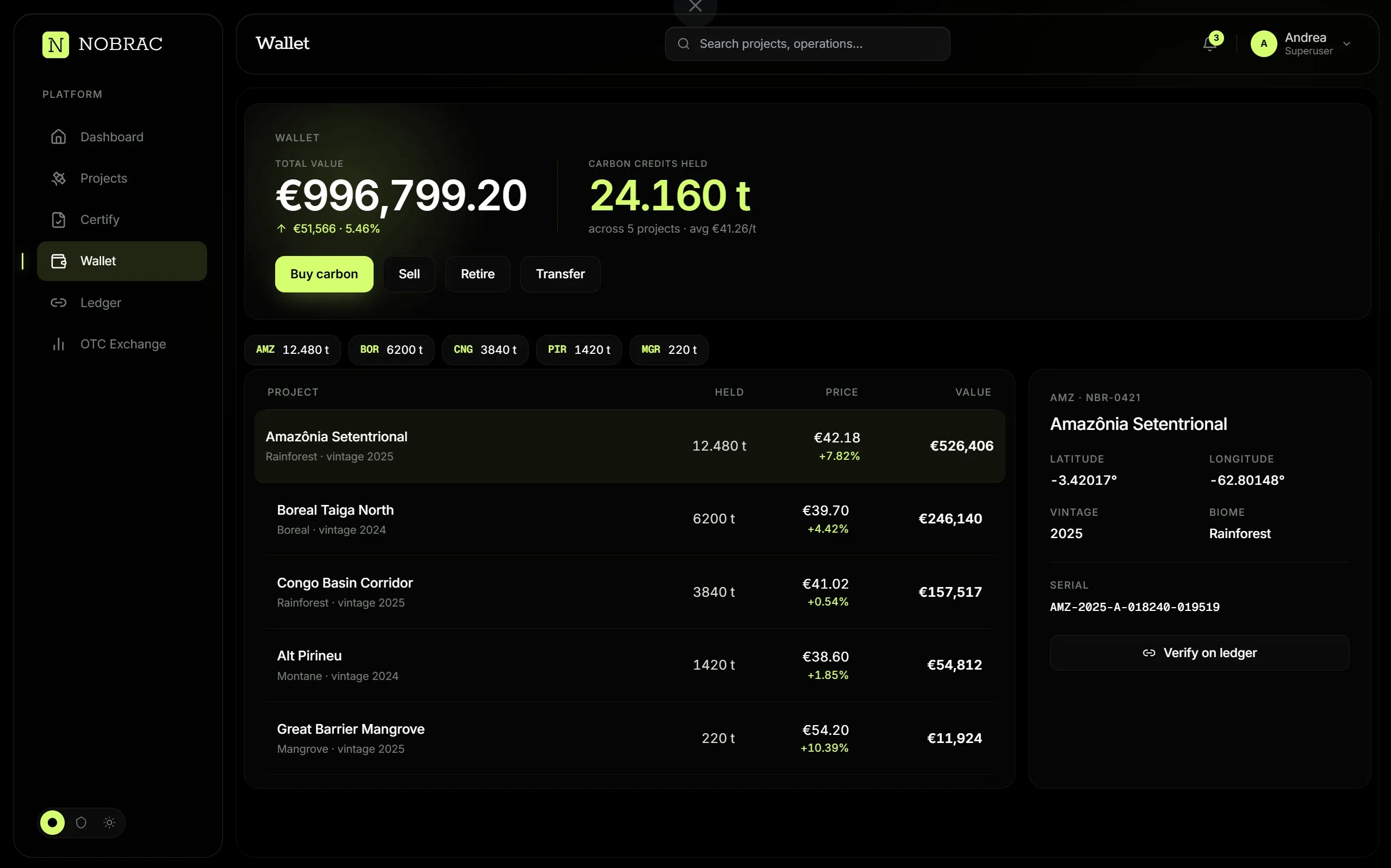
For project developers, credit owners, traders, and buyers, we are developing a digital wallet to hold and manage carbon credits alongside the evidence behind them. Each asset is linked to its originating project, measurement records, verification documentation, and transaction history. Designed to support custody, transfers, and retirement, the wallet brings ownership and traceability into one place.
Learn more
Markets we serve
Forests, supply chains, soils and methane.
Carbon markets span diverse sectors, each with unique measurement and verification needs.
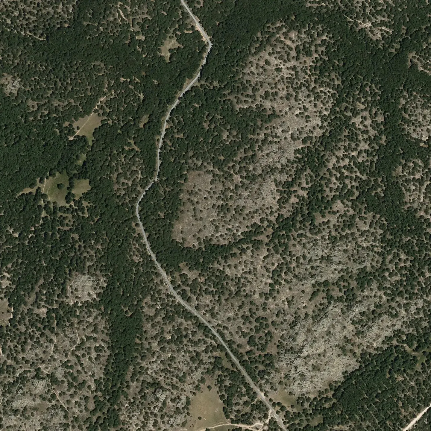
 Pinar de Peguerinos, ÁvilaPNOA 25 cm · crowns by NOBRACMarket 01Afforestation & Reforestation
 Rondônia, BrazilSentinel-2Market 02Deforestation-Free Supply Chains (EUDR)
 Jaú National Park, AmazonasSentinel-2Market 03Forest Conservation & Management
 Vega de Granada, SpainPNOAMarket 04AgricultureIn development
 Escombreras, CartagenaPNOAMarket 05Methane Abatement
Remote certification & compliance
Transparency is our commitment.
Each deliverable comes with a full evidentiary package, connected directly to the underlying data. What you submit always reflects what the system actually measured.
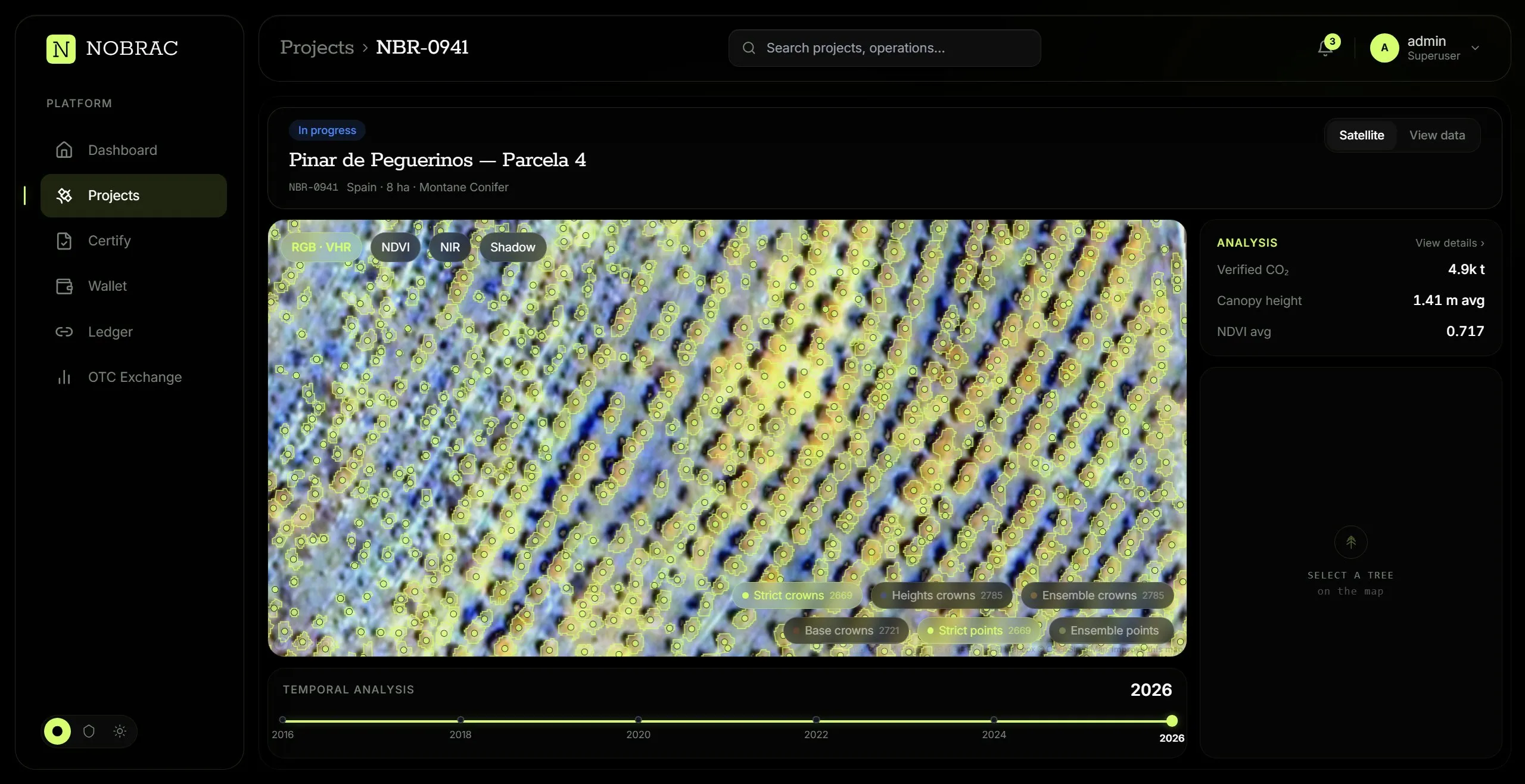
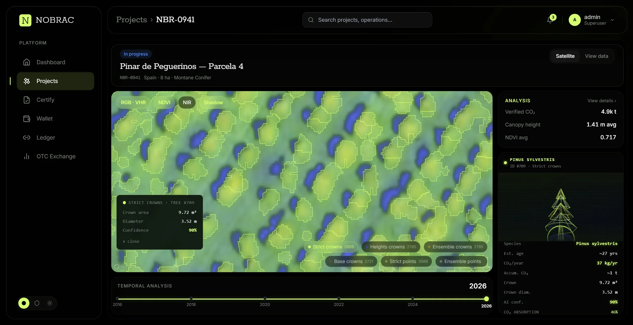
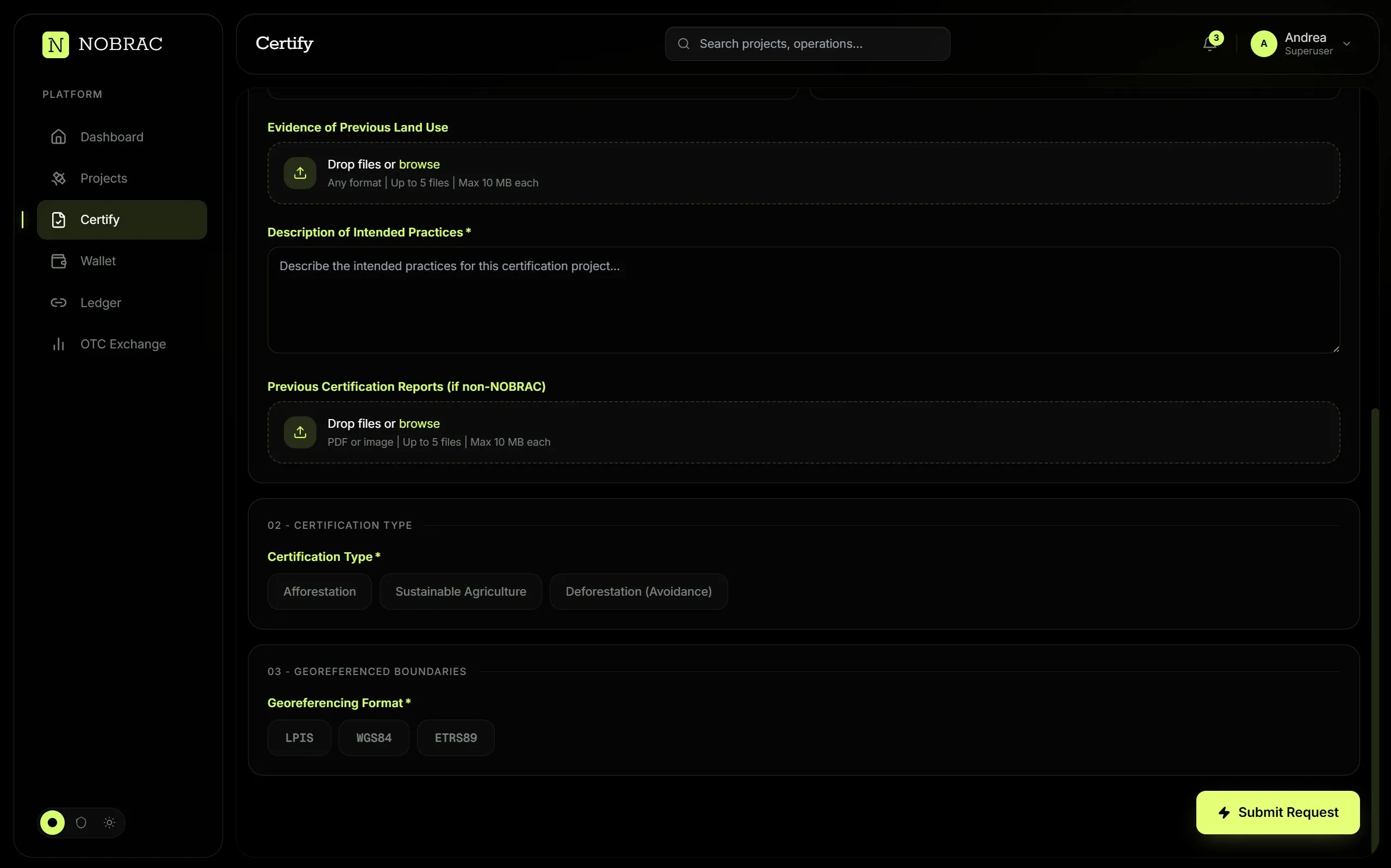
Every image is recorded with date, time, sensor metadata and acquisition geometry, and anchored from the moment it is captured.
The exact segmentation, classification and allometric models behind each result, so it can be reproduced.
Every calibrated run and its parameters, kept with the result instead of in a separate report.
Reference plots with independent measurements (DBH, height, species) cross-checked against the outputs.
Reports for CRCF, EUDR, Paris Art. 6 and EU ETS Phase IV, auto-generated from the underlying data.
Transparent data for meaningful change
Ready to bring trust to your carbon projects?
Pinar de Peguerinos · 40.6412 N 4.1992 W · PNOA © IGN